The Tsetsee Gun East Trail route is located on the slope of Tsetsee Gun mountain (in the Bogd Khan Uul mountains). It is called one of the most interesting cycling routes near Ulaanbaatar. Tsetsee Gun is a well-known peak in the Bogd Khan Uul mountains, whose height above sea level ranges from 2,257-2,258 m. These mountains are part of a protected natural zone that has quite diverse flora and fauna: a huge number of different birds, animals, dense forest in which larches and pines predominate. The gorge/slope is popular amongst tourists and local residents who organise hikes, use it for hiking and cycling. This popularity is largely due to the advantageous location of this slope – not far from the capital. In this overview, we will examine the main features and characteristics of the Tsetsee Gun East Trail cycling route.
Features of the Mountain Route for Cyclists
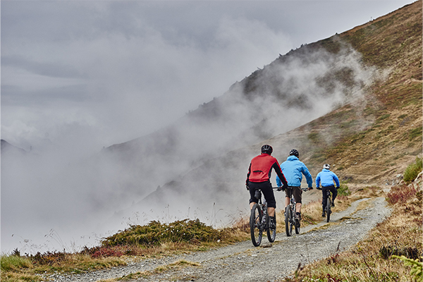
The beginning of the trail is a double-track dirt road. Moreover, most of this road is laid through open terrain located along the forest edge and a small stream. Cyclists note this part of the road as an excellent warm-up before the start of the real ascent.
Travelling along the road for approximately 3.5 km, one can notice how the trail literally approaches the forest closely, and then turns into a perfectly straight trail. To reach the top of Tsetsee Gun mountain, it will be necessary to travel another 5.5 km – cyclists can expect a fairly slow climb upwards. However, the climb is called technically difficult, as in places it becomes quite steep, which may cause some difficulties for beginners.
However, the return journey along this trail is a high-speed descent (classic downhill). Therefore, cyclists must be prepared for the fact that they will have to race at high speed over various bumps, masterfully overcoming any obstacles in their path.
Leaving the forest, cyclists again find themselves on two tracks: here a downhill sprint back to the car awaits them, which stretches for 3.5 km.
At the summit, the cycling trail connects with the Manjushri-Tsetsi Gan trail. If one walks or rides along this trail, one can head south to Zuunmod. This is convenient for a planned transfer from point A to point B or for a longer route there and back.
How to Get to the Start of the Trail: Useful Tips
Before starting a cycling trip, it is necessary to get to the beginning of the trail. To do this, one needs to start movement from the eastern gates of Ulaanbaatar and move east along the main road. It is necessary to travel approximately 11 km to the small village of Khonkhor, which will be located on the right side. Then, one needs to turn right and drive through the village towards the mountain.
From the southern outskirts of the village, it will be necessary to climb up the valley, following first south and then west. After travelling 6 km, one can notice that the dirt road ended in a dead end at two organised camps. Here one can park the vehicle and rest a little.
The needed trail for the cycling trip is located immediately behind the first camp, and therefore, to get onto it, it is sufficient to go around the camp (more precisely, the fence). The trail begins with a double-track dirt-type road, and somewhere after 3.5 km it becomes straight.
Why Tsetsee Gun East Trail Is Interesting for MTB Riders
Tsetsee Gun East is a classic mountain cycling route. The length of the entire trail is approximately 11 miles (17.7 km). The format of this trail can be characterised as “out & back” (there and back along the same route). The riding surface for the most part is a dirt double-track road, which is perfectly suitable for a “warm-up.” The first section runs along the forest zone, which can be called an easy “start” even for beginners.
This route is popular and interesting in the circle of MTB riders for the main reason – it is a gradual “increase in level” of difficulty when passing through. After all, after an easy “start,” riders can expect a singletrack (ST) – a technical climb that in some zones is considered quite steep. Endurance and some cyclist skills will be required here.
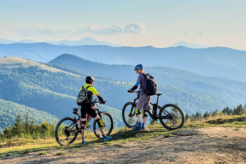
The summit is called a true “reward” for all the efforts made. After all, it is from here that amazing views open up. After surveying the area, cyclists can expect a descent through the forest, which is called technical – with stones, roots, narrow turns, and therefore this ride is considered “adrenaline-filled.”
The final point – after the forest, riders again expect a double-track. This is the final 3.5 km and “DH sprint” back to the car.
The overall “layout” looks as follows:
- Initially, riders can expect an easy climb – a “warm-up.”
- After this, they move on to a more difficult climb plus a technical singletrack.
- Then, a steep descent with a final acceleration awaits them.
Some experienced cyclists have dubbed this route a “4-stage journey/story.”
The difficulty level of the route can be assessed as medium, but approaching “advanced.” After all, cyclists can expect a technical climb, as well as a descent with many stones and roots. Therefore, this route is often chosen by more experienced MTB riders who are confident in their own abilities. These can also be riders who feel comfortable on singletrack, can work with sufficient traction, and know how to fully control a descent of any difficulty level.
To get maximum pleasure from a planned cycling trip, it is necessary to have good physical fitness, as a difficult climb is expected. An equally important condition is also the choice of a reliable bicycle: quality suspension, durable tyres. This should be transport that copes excellently with technical descents.
Tsetsee Gun is suitable not only for cyclists (local and visiting). It is also a popular and no less interesting place for hiking/walking routes. After all, here there is everything necessary for calm and comfortable rest: forest, clean air, nature, beautiful views.